University research · field teams · instruction

Field science at landfall.

Universities use mobile observing teams, deployable instruments, aircraft partnerships and supervised field courses to study severe weather. Hurricane programs focus on tropical-cyclone measurements, while many storm-observation courses concentrate on Great Plains supercells and tornadoes.

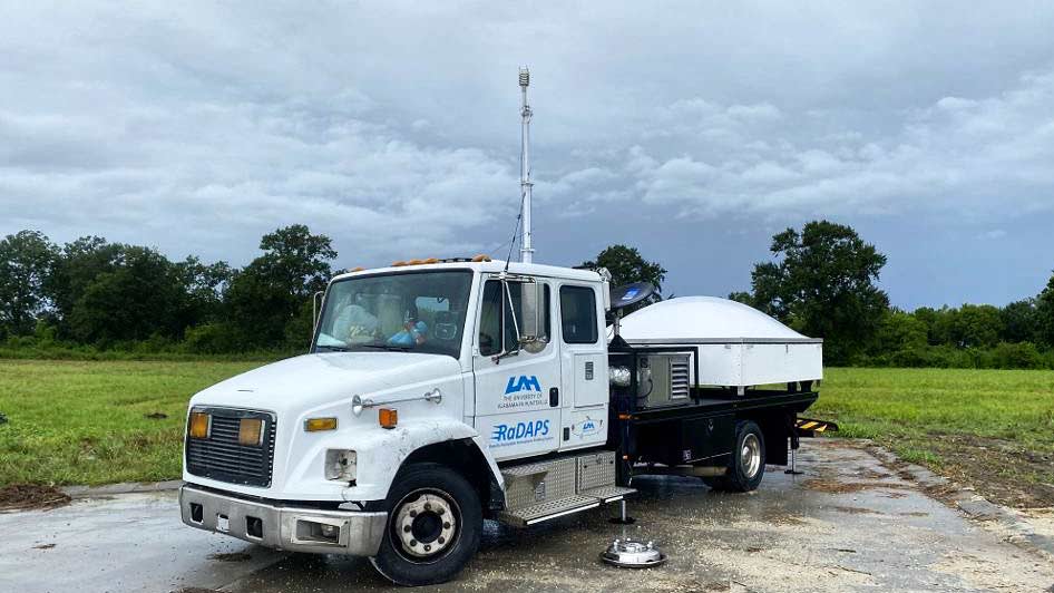
University of Alabama in Huntsville RaDAPS mobile atmospheric profiling truck deployed for Hurricane Ida
UAH's RaDAPS mobile atmospheric profiling system during the Hurricane Ida deployment. University of Alabama in Huntsville. Source ↗
DeployPlace wind, pressure and rain instruments before landfall.
ObserveDocument coastal conditions, damage and structural performance.
FlyJoin supervised research or operational aircraft programs.
TeachUse forecasting and field observation in structured courses.
Hurricane-specific programs

Research at landfall

These programs deploy people and instruments for tropical-cyclone research under coordinated safety plans and scientific objectives.

Texas Tech University · National Wind Institute

Hurricane Research Team and StickNet

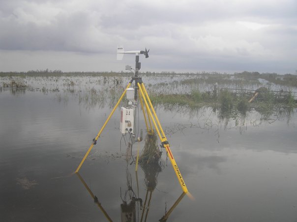
The Hurricane Research Team has documented landfalling tropical cyclones since 1998. StickNet began as a 2005 atmospheric- and wind-science class project; students designed the rapidly deployable platform, and the fleet first sampled Hurricanes Dolly and Ike in 2008. The team now operates 48 towers and two mobile Doppler radars.

NOAA · university partners

Hurricane Field Program

NOAA’s program coordinates aircraft, ocean, satellite and landfall experiments. University investigators have come from Miami, Florida, Oklahoma, Alabama–Huntsville, Mississippi State, Texas Tech, Colorado State, New Mexico Tech and other institutions.

University of Florida · coastal engineering

Project Sentinel and rapid coastal surveys

UF researchers combine portable towers with coastal reconnaissance before and after landfall. Project Sentinel extends instrument coverage along the Atlantic and Gulf coasts, while post-storm teams document surge, erosion and damage that instruments alone cannot explain.

U.S. Naval Academy · supervised internships

Airborne hurricane experience

The Naval Academy’s oceanography program lists summer internships that can include flying through hurricanes as well as severe-storm field work. This is a structured academic and professional pathway, distinct from independent ground interception.

NOAA · collegiate aviation universities

Cooperative Aviation Centers

NOAA’s Cooperative Aviation Centers connect accredited university aviation programs with NOAA Corps training. Participating students enter real scientific flight operations—including aerial data collection and hurricane reconnaissance—under structured university and NOAA standards.

National Taiwan University · College of Science

Typhoon Research Center and DOTSTAR

Founded in 2009, NTU’s Typhoon Research Center studies targeted observations, data assimilation, typhoon dynamics, ocean interaction and rainfall. Its DOTSTAR aircraft program has used dropsondes around western North Pacific typhoons to improve analysis and forecasting while training new researchers.

Multi-university coordination

Digital Hurricane Consortium

This network coordinates portable weather stations and mobile Doppler radars around landfall. Federal records identify participants from Florida, Texas Tech, Louisiana State, Notre Dame, Alabama–Huntsville, Oklahoma, Colorado, Clemson and the Center for Severe Weather Research.

Additional documented teams

Mobile instruments and coastal surveys

University hurricane work is distributed across atmospheric science, wind engineering and coastal engineering. These teams often collaborate, positioning different instruments around the same landfall.

InstitutionField systemDocumented hurricane work
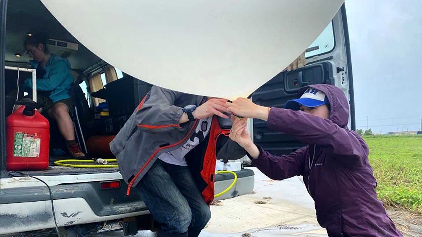
University of Alabama in Huntsville ↗Mobile radar, profilers and balloonsTen students and staff deployed five instrumented vehicles for Hurricane Ida. UAH later incorporated the FARM mobile-radar facility, whose record includes observations of 18 landfalling hurricanes.
University of Oklahoma ↗SMART and RaXPol mobile radarA faculty, graduate-student and research team deployed for Hurricane Harvey to study eyewall circulation, inland flooding and tornadoes in outer rainbands. OU’s community RaXPol program also supports student-led virtual and on-site field campaigns.
University of Washington RAPID Facility ↗Drones, sonar and wave gaugesThe team collected pre-, during- and post-landfall coastal data for Hurricane Helene; an undergraduate designed gauges used in the deployment.
Florida Institute of Technology ↗Pressure, temperature and wind sensorsEngineering and meteorology faculty and students deployed instruments in advance of Hurricane Ian.
University of South Alabama ↗Surge and wave gaugesA faculty-and-student extreme-events deployment group builds and places coastal instruments around approaching storms.
Related academic field courses

Severe-storm classrooms

These courses teach forecasting, instrumentation and field decision-making primarily through supercells and tornadoes.

InstitutionTypeDocumented activity
University of North Dakota ↗Two-week field classStudents forecast and observe Great Plains supercells while learning storm development and field decision-making.
Texas A&M University ↗Field class and student clubFaculty describe a storm-chasing field class; the university also documents the Texas Aggie Storm Chasers.
College of DuPage ↗NEXLAB chase tripsRecurring instructional trips combine forecasting with field observation and a public archive of chase logs.
SUNY Oswego ↗Student field programA program dating to 2007 takes students into Tornado Alley for forecasting, observation and balloon launches.
Fort Hays State University ↗Severe Storm ObservationsA credit-bearing field course emphasizes forecasting, storm structure, safety and direct observation.
Florida State University and Texas A&M ↗Gulf Coast radar field campaignAn NSF-supported 2026 project places undergraduate and graduate students at FSU’s Coastal and Marine Laboratory for forecast briefings, supervised RaXPol operation and deployment decisions. The coastal course can observe tropical systems, but is not advertised as a hurricane-chasing class.
Standards and limits

A course is not a license to take risks.

The American Meteorological Society’s faculty course guidance emphasizes safety, atmospheric measurements, student learning, limited budgets and accessibility. The University of Oklahoma’s meteorology guidance separately distinguishes sanctioned, safety-trained scientific projects from casual student chasing.