Reconnaissance before the Hurricane Hunters

The early hurricane flights.

A Cuban-led search located the 1935 Labor Day hurricane. Four days later, a TWA research aircraft penetrated the same cyclone. Joseph Duckworth’s 1943 center crossings then became the best-known bridge to sustained military reconnaissance.

Four different milestones

Povey’s flight was an aircraft search mission: he found and circled the storm but did not enter it. Tomlinson’s TWA crew later used the cyclone for meteorological research and passed through its weakened center at high altitude. Duckworth’s 1943 flights made two deliberate, instrumented center crossings at lower altitude. The recurring, tasked service now associated with “Hurricane Hunters” developed separately. None was a civilian land chase of the kind later practiced by Jim Leonard.

Havana and the Florida Straits · 1935

Leonard Povey finds the storm.

On September 2, a Pan American pilot arriving in Havana reported dark weather farther north than forecast. Dr. Juan Carlos Millás of Cuba’s National Observatory asked the Cuban Army Air Corps to locate the hurricane. Its chief training pilot, Leonard J. Povey, volunteered to search.

Povey departed Havana in an open-cockpit Curtiss Hawk II. He found the cloud mass farther north than the prevailing forecast, circled its edge to judge its movement, and reported that the hurricane was heading toward the Florida Keys. The open cockpit made a cloud penetration impractical, so he observed the storm from its periphery rather than entering the eye.

The Associated Press revisited the mission three weeks later. Its account recorded Povey’s view of a cone-shaped cloud mass and violent crossing seas, and reported Cuban interest in using aircraft to scout future hurricanes. Free scans of the syndicated report survive in more than one American newspaper. The original September 3 Havana Post front page cited by historians has not been located in a free public digital archive.

After the disaster, Povey traveled to Miami and argued that the United States should fund Cuban reconnaissance flights. The U.S. Weather Bureau broadened the idea into a proposal to hire commercial aircraft, but federal officials chose a Coast Guard surface patrol instead. That plan was never fully carried out, leaving the 1935 flight as a demonstrated capability rather than the beginning of a continuous service.
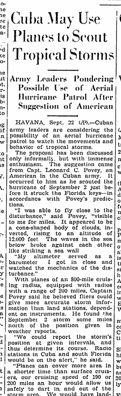
A Cuban milestone with an American pilot Povey was an American expatriate, but the mission was requested in Havana, flown in a Cuban military aircraft and carried out for the Cuban weather service. The first known hurricane-location flight therefore belongs to both Cuban meteorological history and the wider history of aerial reconnaissance.
September 23, 1935 Schenectady Gazette clipping titled Cuba May Use Planes to Scout Tropical Storms
“Cuba May Use Planes to Scout Tropical Storms,” Associated Press, Schenectady Gazette, September 23, 1935, p. 7. This high-resolution crop was reconstructed from the newspaper’s public-domain Google News Archive scan.
Readable account What the 1935 report established
  • Povey located the hurricane from a Cuban Army aircraft after surface observations no longer agreed on its position.
  • He described an inverted, cone-shaped cloud mass rising to about 12,000 feet and seas colliding below it.
  • The report said Cuban officials were considering aircraft patrols to locate future tropical cyclones before they reached land.
Open the Schenectady Gazette page →

Open the free St. Petersburg Times scan →

How the warning moved on September 2

10:30 a.m. Pan Am arrives A Key West–Havana pilot reports the cloud mass north of its forecast position.
Havana Millás requests a search Cuba’s National Observatory asks the Army Air Corps to locate the storm.
Florida Straits Povey finds and circles it He establishes that the hurricane is farther north and moving northwest.
Relay Havana contacts Jacksonville The Cuban Observatory passes Povey’s position and motion to the U.S. warning center.
4:30 p.m. Keys warnings are raised Jacksonville issues a special bulletin as the hurricane closes on the Upper Keys.
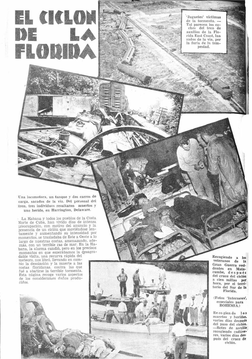
Page 32 of the September 15, 1935 Cuban magazine Bohemia, titled El Ciclón de la Florida
“El Ciclón de la Florida,” Bohemia, Havana, September 15, 1935, p. 32. Biblioteca Nacional de Cuba copy preserved by the Digital Library of the Caribbean.
Havana’s contemporary record · 1935

Cuba watches the cyclone turn north.

The Cuban weekly Bohemia described Havana and communities along Cuba’s north coast living through days of intense concern as the cyclone moved west and strengthened offshore.

Its September 15 issue recorded the feared threat to Havana, including the prospect of a destructive storm surge, followed by the abrupt turn that spared the city and carried the hurricane into the Florida Keys. The illustrated page paired that Cuban account with photographs of wrecked Florida East Coast Railway equipment, veterans being evacuated from Matecumbe and boats recovering the dead and injured.

This Spanish-language account places Povey’s Havana-based search mission inside the public anxiety that surrounded the storm in Cuba. It also shows how quickly the event entered a shared Caribbean news record rather than a purely American history.

Mid-Atlantic coast · September 6, 1935

Tomlinson turns a cyclone into a laboratory.

Four days after Povey’s search, TWA chief research test pilot Daniel Webb “Tommy” Tomlinson encountered the same system after it had crossed Florida, moved up the East Coast and reintensified over the Gulf Stream.

A 2023 Air Force Historical Foundation study reconstructs the flight from aviation records. Tomlinson diverted TWA’s modified DC-1 flying laboratory toward the storm while investigating icing and severe-weather flight. At about 27,000 feet, the crew probed through the cyclone’s weak center. They descended to about 25,000 feet, met severe turbulence and torrential rain, and abandoned the test before landing at flooded Newark.

This was not a locating mission like Povey’s and not an operational center fix for a warning service. It was corporate meteorological research. Its survival in the aviation record also means that the common claim that the 1943 Duckworth mission was the first flight into a hurricane is too broad.

Conceptual reconstruction—not a plotted flight track. The published account places the DC-1 in the reintensified cyclone at 27,000 feet before the crew descended and encountered severe weather.
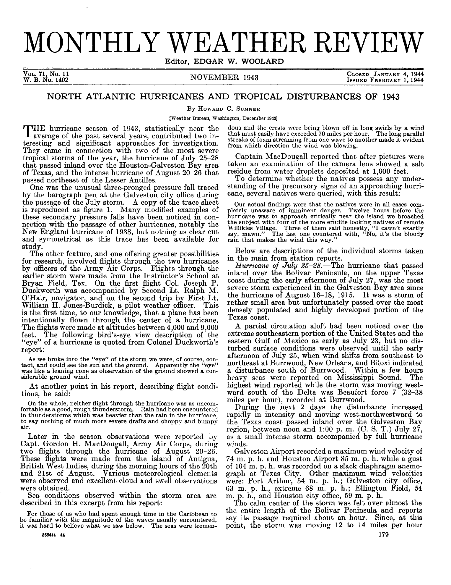
Page 179 of the November 1943 Monthly Weather Review describing Joseph Duckworth's hurricane flights
The U.S. Weather Bureau’s contemporary account, published in the November 1943 Monthly Weather Review. Select the page for the complete report.
Bryan Field, Texas · 1943

Joseph Duckworth crosses the eye.

On July 27, Colonel Joseph P. Duckworth flew a single-engine AT-6 trainer through the hurricane moving inland over the Houston–Galveston region. He made the crossing twice.

Second Lieutenant Ralph M. O’Hair navigated the first flight. First Lieutenant William H. Jones-Burdick, the field’s weather officer, joined the second and recorded observations. The flights ranged from about 4,000 to 9,000 feet. Duckworth described a calm, sunlit center whose shape appeared like a leaning cone, with wind still visible at the ground below.

The Weather Bureau described this as the first intentional flight through a hurricane center “to our knowledge.” Later aviation research documents earlier storm crossings, including Tomlinson’s 1935 research penetration. Duckworth’s secure historical place is narrower but still important: two well-documented center crossings with a weather officer and recorded observations.

Later retellings often frame the first flight as a wager with British trainees. That detail is absent from Duckworth’s report and the contemporary Weather Bureau account. The early record securely establishes the two flights, their crews and their observations; the wager belongs to the later oral tradition.

Duckworth’s experiment was not the origin of the operational program. A joint hurricane-warning center was already assigning military aircraft to monitor tropical disturbances. About a month later, Royal Air Force and U.S. Army Air Forces crews made the first tasked hurricane-reconnaissance fixes east of the Bahamas. Interagency planning in 1944 turned those missions into a regular service.

The sequence

From search flight to service.

Milestone Purpose What happened Historical place
1935 · Povey Locate a hurricane threatening Cuba Found and circled the storm; no penetration First known aircraft mission specifically to locate a hurricane
1935 · Tomlinson Meteorological research Passed through a weak center at high altitude Early documented hurricane penetration; not an operational fix
1943 · Duckworth Test flight and direct observation Two intentional crossings of the center Contemporary Weather Bureau “first” claim; later evidence complicates it
1943–1944 · Military crews Operational fixes and meteorological reports Tasked Caribbean flights followed by a regular program Beginning of sustained hurricane reconnaissance